Jump to content


Fish Species Mapping Tool


  • Please log in to reply
10 replies to this topic

#1 Guest_rc6750_*

Guest_rc6750_*
  • Guests

Posted 13 June 2013 - 10:36 AM

Hi all -

I have just launched a new tool for mapping fish species and wanted to get the word out. Fishmap.org shows you fish species by U.S. watershed and shows you what watersheds a species can be found in. I wanted to find out what species were near me so I converted the data from NatureServe and decided to share the data with others who might also be interested.

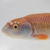
Example below: Blue Ridge Sculpin

Posted Image

This is still in testing mode and I have a few tasks left to address:
  • I need to finish entering the watersheds of exotic established species
  • I need to create KML files for the exotics (this will take some time)
  • I made a mistake when creating the database and did not take into account historic vs. current ranges. I will be addressing these species by species and updating the data. Currently almost all species are listed as current so use caution with historic vs current until I correct this. Drop me a message if you need to know before it is fixed.
A few notes:
  • The Google earth plug-in is required to view the maps. I may change how this works later, but for now the plug-in is required.
  • I do not have data for Alaska, Canada, Hawaii, or the Caribbean. Please provide feedback if you have any.
  • For obvious reasons, this does not include saltwater fish - I may include saltwater species somehow at a later time.
  • Each species has a link for roughfish.com (if they have a record), FishBase, ITIS, Wikipedia, and Google image search
  • You can find your watershed by entering your 5 digit US zip code.
As I stated before, this is still new and in testing, please let me know any issues or feedback you have. I look forward to any feedback and I hope some of you find this useful. Let me know if you have any questions

thanks

Ryan

#2 Guest_clemsons2k_*

Guest_clemsons2k_*
  • Guests

Posted 13 June 2013 - 10:46 AM

Awesome! This should come in real handy once it starts getting more info in it.

#3 Guest_biggreenavalanche_*

Guest_biggreenavalanche_*
  • Guests

Posted 13 June 2013 - 01:08 PM

Wow ! This app/program will be a hit for sure !

#4 Guest_jblaylock_*

Guest_jblaylock_*
  • Guests

Posted 14 June 2013 - 09:07 AM

Very cool. Is there a mobile version or app for Android/iOS?

#5 Guest_FirstChAoS_*

Guest_FirstChAoS_*
  • Guests

Posted 14 June 2013 - 12:51 PM

Any way to add tributaries to it? alot of rivers flow into the middle connecticut.

Also their is no native musky their despite what natureserve thinks (at least in NH and VT, I never checked mass). And silver trout should be listed as historic.

Otherwise, good work, this is a program I have been waiting for for a while. Narrow it down to smaller scale tributaries and it'd be perfect.

Edited by FirstChAoS, 14 June 2013 - 12:56 PM.


#6 Guest_Skipjack_*

Guest_Skipjack_*
  • Guests

Posted 14 June 2013 - 01:04 PM

Otherwise, good work, this is a program I have been waiting for for a while. Narrow it down to smaller scale tributaries and it'd be perfect.


Good luck, give him about 5 years.

#7 Guest_Kanus_*

Guest_Kanus_*
  • Guests

Posted 14 June 2013 - 01:15 PM

That is fantastic. I will definitely be using this a bunch. Are/will you be accepting records of range extensions and such, if new discoveries are made? I understand it would be a big undertaking, and many records do not have adequate proof to warrant serious consideration, I was just wondering. I have tried to contact Natureserve in the past with additional data, and never got a response from anyone despite multiple efforts.

#8 Guest_pylodictis_*

Guest_pylodictis_*
  • Guests

Posted 14 June 2013 - 01:23 PM

This is awesome! I wonder how accurate the Natureserve data is? Here in VA the information I get from the DGIF is not the most accurate, they seem to believe dams are absolute barriers to fish passage and I've been told several times "No, there are none of those below that dam, only above it." or "No, those only live in the far upper reaches of that river." and I end up finding that species miles away from where they say the range stops. Examples include walleye, musky and flathead catfish, I've never asked them about some of our smaller species though. I learned my lesson about trusting range maps when I saw the head of the "northern water snake" I was picking up(it was a cottonmouth)!


Also, Derek, that is a good idea. It would be really cool if through a collaboration of NANFA members we could actively update range data that is avalible. I can't imagine anyone would lie! We could just have people send in a photo to prevent misidentification of the species.

Edited by pylodictis, 14 June 2013 - 01:32 PM.


#9 Guest_rc6750_*

Guest_rc6750_*
  • Guests

Posted 14 June 2013 - 01:37 PM

Very cool. Is there a mobile version or app for Android/iOS?


Not yet - but there are definitely plans for both longer term. Part of the reason why I am reconsidering another option for maps besides GE plug-in is because of lack of mobile support.

Any way to add tributaries to it? alot of rivers flow into the middle connecticut.

Also their is no native musky their despite what natureserve thinks (at least in NH and VT, I never checked mass). And silver trout should be listed as historic.

Otherwise, good work, this is a program I have been waiting for for a while. Narrow it down to smaller scale tributaries and it'd be perfect.


Thanks - I have to fix the current/historic data for sure. If tributary data ever becomes available I will certainly add it.

That is fantastic. I will definitely be using this a bunch. Are/will you be accepting records of range extensions and such, if new discoveries are made? I understand it would be a big undertaking, and many records do not have adequate proof to warrant serious consideration, I was just wondering. I have tried to contact Natureserve in the past with additional data, and never got a response from anyone despite multiple efforts.


Absolutely be accepting info and feedback. I haven't figured out how to qualify information, but if you look at the records I have now I list the Source of the information. One source will be "user reported" or something. Again, I need to figure out a method for this but yes my idea is that this should be a living data set.

This is awesome! I wonder how accurate the Natureserve data is? Here in VA the information I get from the DGIF is not the most accurate, they seem to believe dams are absolute barriers to fish passage and I've been told several times "No, there are none of those below that dam, only above it." or "No, those only live in the far upper reaches of that river." and I end up finding that species miles away from where they say the range stops. Examples include walleye, musky and flathead catfish, I've never asked them about some of our smaller species though. I learned my lesson about trusting range maps when I saw the head of the "northern water snake" I was picking up(it was a cottonmouth)!


Also, Derek, that is a good idea. It would be really cool if through a collaboration of NANFA members we could actively update range data that is avalible. I can't imagine anyone would lie! We could just have people send in a photo to prevent misidentification of the species.


Not entirely sure how accurate the data is, but this is from their site "NatureServe zoologists combed the published literature, interviewed regional ichthyologists, and solicited data from state natural heritage programs to develop the database. Subsequent review by ichthyologists, particularly those at the USGS, has improved the accuracy and completeness of the database."

#10 Michael Wolfe

Michael Wolfe
  • Board of Directors
  • North Georgia, Oconee River Drainage

Posted 14 June 2013 - 02:24 PM

nice work Ryan, this is much more user friendly than Natureserv maps

everyone else, I think Ryan is using the Natureserv data to build the graphics and such, so this will only be as good as the natureserv data is... if we want more details, we need to make that data set better.
Either write something worth reading or do something worth writing. - Benjamin Franklin

#11 Guest_rc6750_*

Guest_rc6750_*
  • Guests

Posted 24 June 2013 - 03:42 PM

FYI - Historic vs Current range information has been updated. The KMZ map files themselves still need to be updated with a different color shade, but the listing data below is now accurate.


2 user(s) are reading this topic

0 members, 2 guests, 0 anonymous users