Getting back to the trip report...
On May 5th, I had the pleasure of meeting Uland Thomas (Teleost) in Indiana for a day long trip in Indiana and Illinois. I brought my younger brother with as well. Here's how the day went;
Date: May 5, 2007
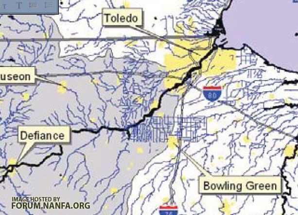
Location: Tippecanoe River, near Beardstown, IN. off Rte. 35, in Tippecanoe River State Park.
Water Level: Quite high. There was a good deal of flooding, and a few feet from the bank there were drop off dropping to at least 3-5 feet in depth.
Water Quality: Even though the water was high, it was not very muddy. It did have a slight brown stain to it though.
Water Temp.: Probably upper 50s*F
Substrate: Areas of sand and mud. We sampled near the shoreline among vegetation and fallen timber.
Air Temp.: Mid 60s*F
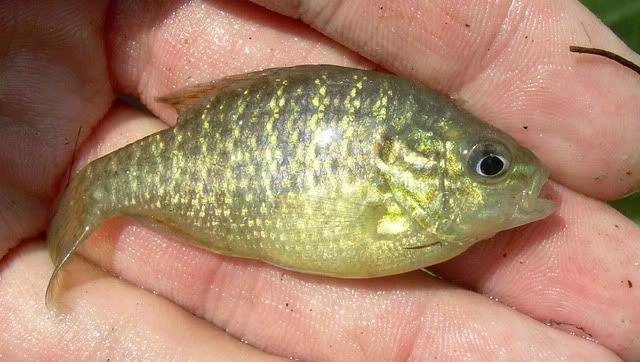
Collected:- Warmouth (Lepomis gulosus) -right when we found this sunfish species we knew we werent going to be finding any of the darters we were looking for
- Emerald Shiner (Notropis atherinoides)
- Sand Shiner (Notropis stramineus)
- Spotfin Shiner (Cyrpinella spiloptera)
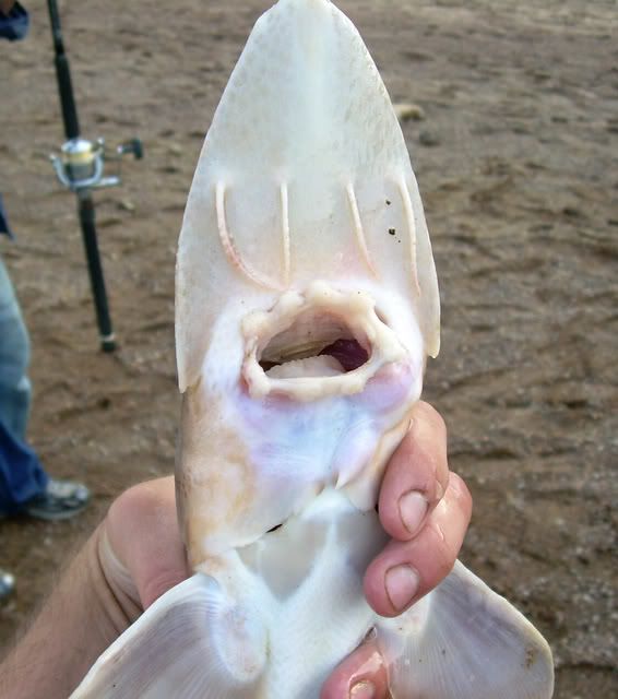
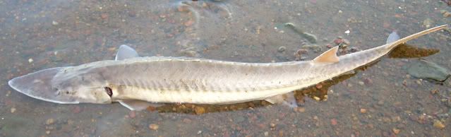
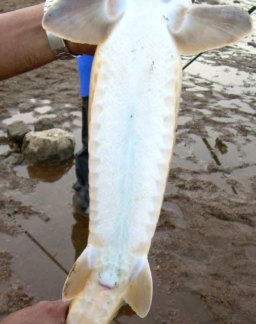
Unfortunately, the water was too high to get to any riffles. The area is reported to have Gilt, Bluebreast, and Tippecanoe Darters. We didn't spend much time here due to the conditons.
After this stop, we shot out to Jasper-Pulaski Fish and Wildlife Area.
Date: May 5, 2007
Location: Jasper-Pulaski Fish and Wildlife Area, in Jaspar County, near Medaryville, IN.
Water Level: We sampled a small ditch on the side of the paths in this park. The ditches we were in were no deeper than waist deep.
Water Quality: Very stained water. Almost bog-like condition water.
Water Temp.: Low 60s*F (estimated)
Substrate: All sorts of aquatic vegetation, debris, and muck formed the bottom of the ditch.
Air Temp.: mid 60s*F
Collected:- Central Mudminnow (Umbra limi)
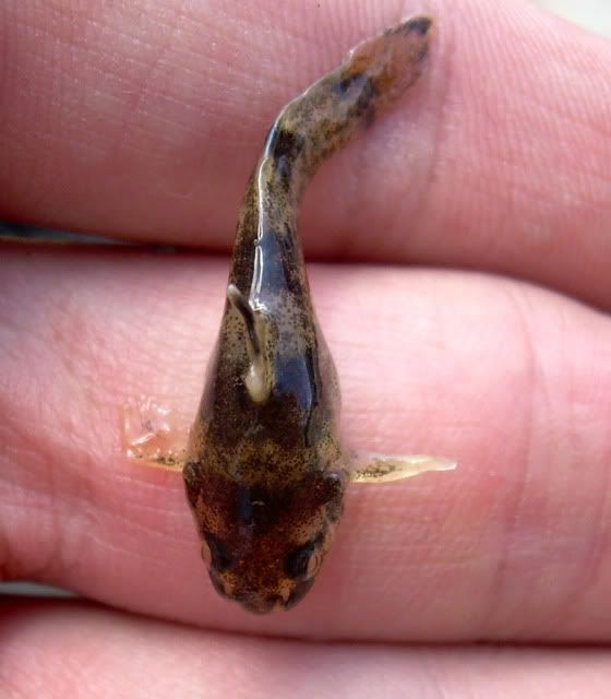
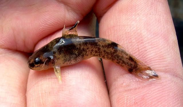
- Grass Pickerel (Esox americanus vermiculatus) - one very tiny young of the year was collected
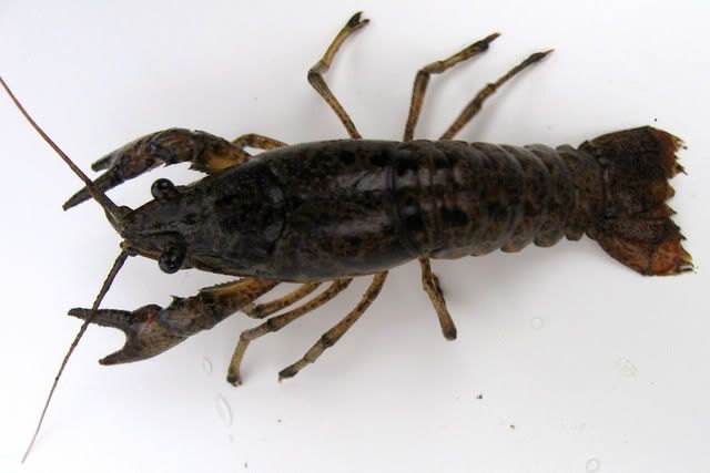
Also captured a small snapping turtle. This area looked like it could have also had Largemouth Bass and Northern Pike. It was an interesting park though. There was a really diverse snail population here as well. Also noted were crawfish with very small claws and soft shells. We only spent a small amount of time here as well, Uland had another spot in mind.
Date: May 5, 2007
Location: -Secret Area-
Water Level: Area sampled was a shallow, slow, ditch/oxbow area overrun with aquatic vegetation.
Water Quality: The water was clear and loaded with vegetation.
Water Temp.: Low 60s*F (estimated)
Substrate: Lots of aquatic vegetation. Some fallen trees. Bottom was sand and muck.
Air Temp.: Mid 60s*F
Collected:- Northern Starhead Topminnow (Fundulus dispar dispar) - there was an abundance of F. dispar here. Every seine haul seemed to yield at least a few. These fish were all over the backwater sloughs here.
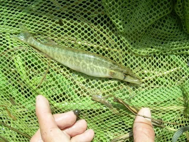
- Grass Pickerel (Esox americanus vermiculatus)
- Central Mudminnow (Umbra limi)
Uland said he has found Bowfin here before, so we spent a little bit looking for them, without any success...oh well, next time.
This last spot that we stopped was my favorite spot of the day. It will be obvious why...
Date: May 5, 2007
Location: -Secret Ditch- in the Kankakee River drainage, in IL.
Water Level: According to Uland Thomas, the water in the ditch was much higher than usual. For the most part, the ditch was probably a little less than 1.0m deep. No more than 2.5 meters wide.
Water Quality: The water was very muddy, perhaps due to recent rain. Low gradient.
Water Temp.: Low 60s*F (estimated)
Substrate: Mostly muck and sand. Long grass lined the ditch, as it does for most ditches in the Midwest.
Air Temp.: Mid 60s*F
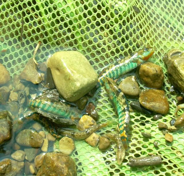
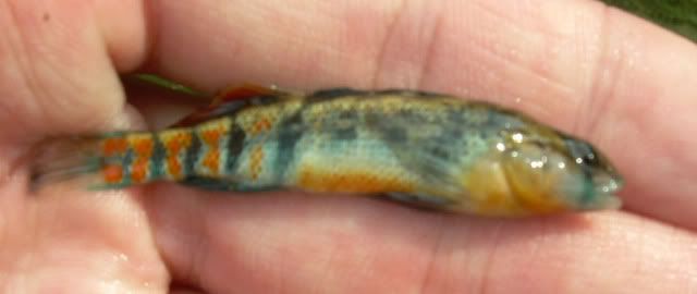
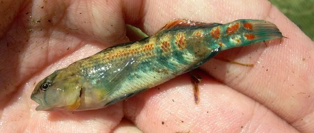
Collected:- Least Darter (Etheostoma microperca)
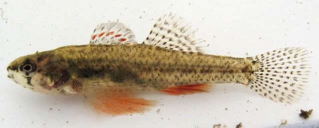
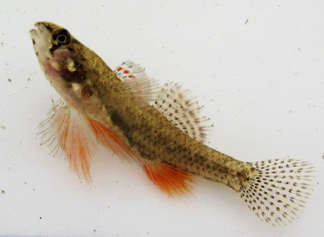 - Least Darter were the most common darters here in this low gradient ditch.
 - Johnny Darter (Etheostoma nigrum)
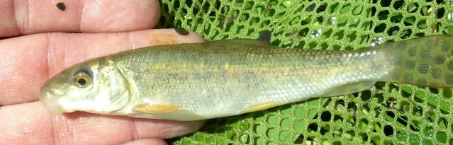
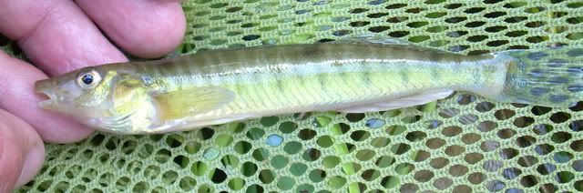
- Hornyhead Chub (Nocomis biguttatus)
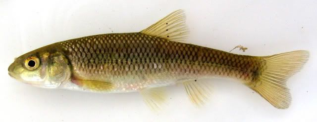 - 1st picture is a male perhaps and the 2nd a female?
 - Lake Chubsucker (Erimyzon sucetta)
 - this is an older picture that was taken by me of a Lake Chubsucker that came from this area.
 - Central Mudminnow (Umbra limi)
- Grass Pickerel (Esox americanus vermicalutus)
- Blackstripe Topminnow (Fundulus notatus) - it was interesting to see F. notatus alongside F. dispar dispar.
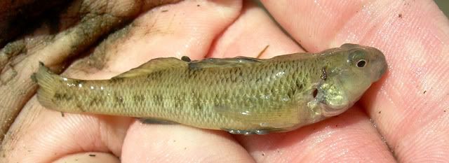
- Pirate Perch (Aphredoderus sayanus)
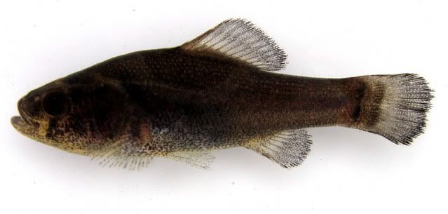 - there were lots of Pirate Perch here. Prior to this I have only seen 4 Pirate Perch ever. Must have caught at least 15 here.
 - Northern Starhead Topminnow (Fundulus dispar dispar)
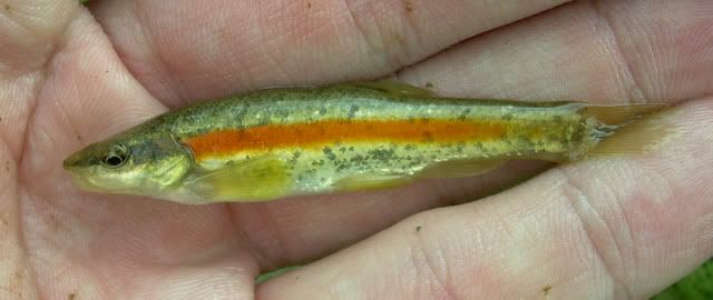
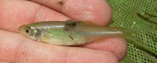
- Ironcolor Shiner (Notropis chalybaeus)
- Spotfin Shiner (Cyprinella spiloptera)
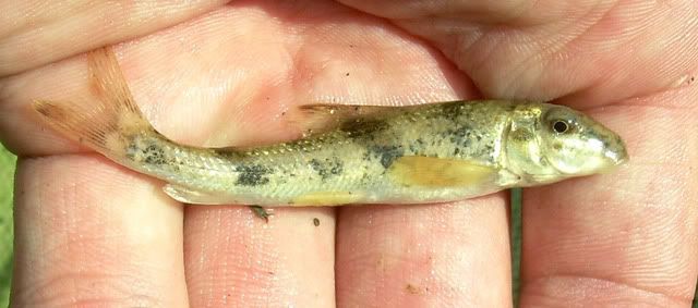
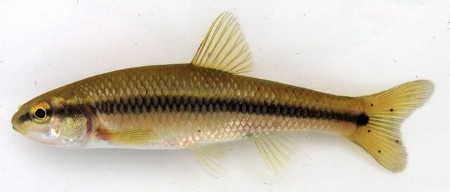
- Bluntnose Minnow (Pimephales notatus)
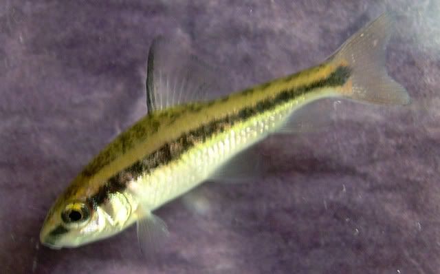
- Fathead Minnow (Pimephales primelas)
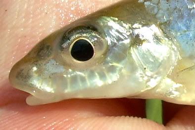
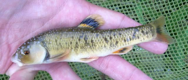
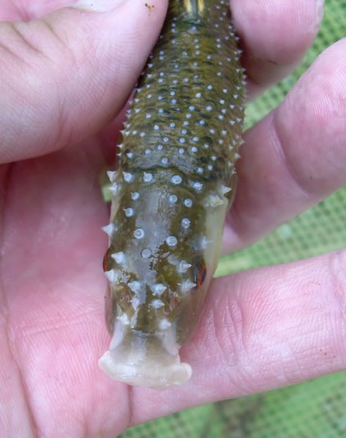
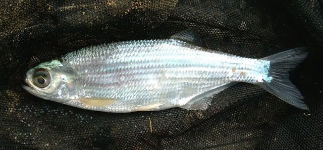
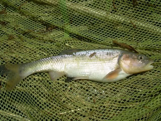
- Golden Redhorse (Moxostoma erythrurum)
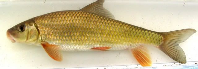
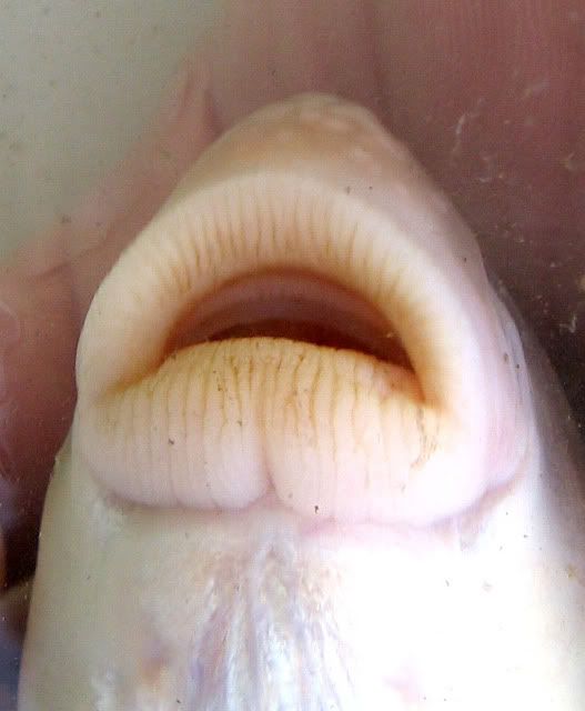 - this Golden Redhorse was the first that Uland has encountered in this ditch. The snout is blunt to rounded but not overhanging the mouth, whereas the Black Redhorse has a rounded and swollen snout that slightly overhangs the mouth ventrally (Fishes of Wisconsin).
 - Bluegill (Lepomis macrochirus)
- Green Sunfish (Lepomis cyanellus)
- Hybrid Sunfish (Lepomis hybrid)
- Northern Longear Sunfish (Lepomis megalotis peltastes)
- Brook Silverside (Labidesthes sicculus)
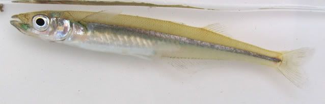 - this was the 1st Brook Silverside that Uland has seen in this ditch.
 - Rock Bass (Ambloplites ruprestris)
- Tadpole Madtom (Noturus gyrinus) - these were quite abundant as well.
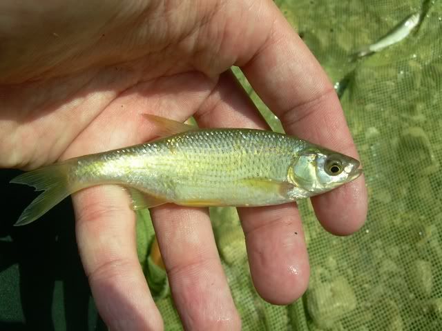
- Redfin Shiner (Lythrurus umbratilis)
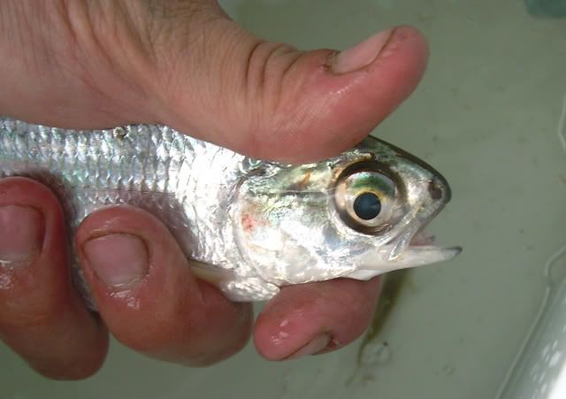
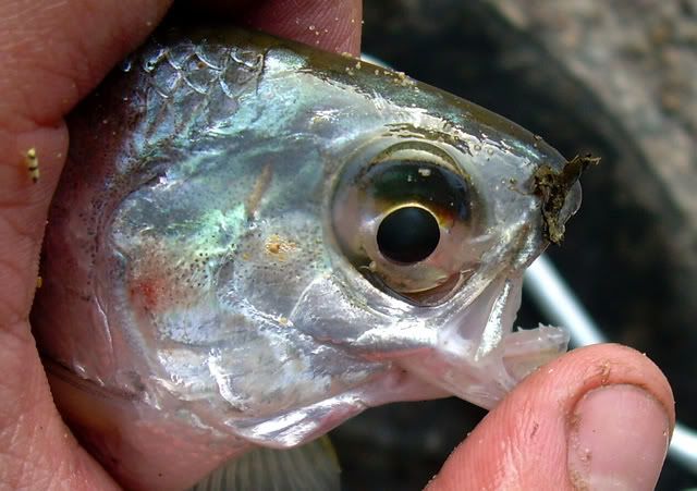
- Emerald Shiner (Notropis atherinoides)
- Sand Shiner (Notropis stramineus)
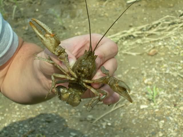
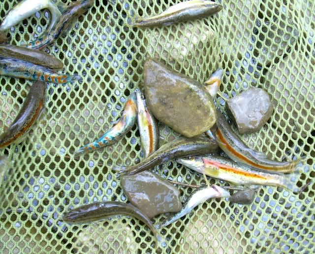
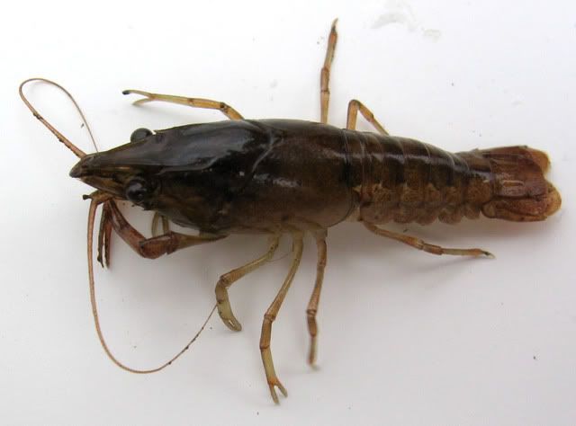
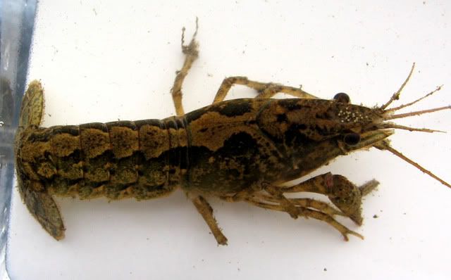
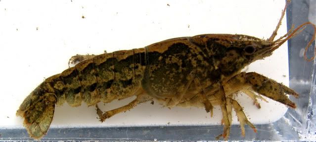
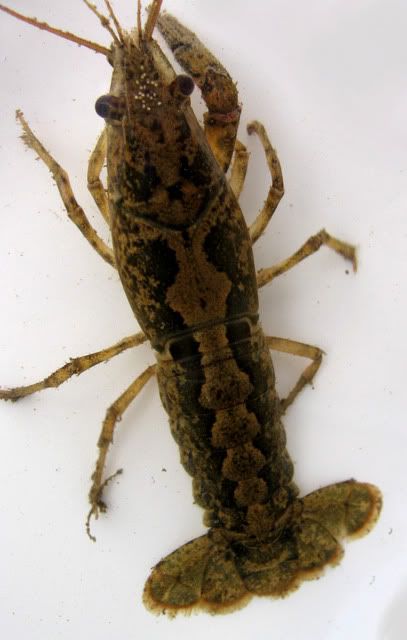
A great assemblage of fish in this small ditch. There was also a great diversity of crayfish here too. Not sure as to what species they are

 - this was the most common sunfish species in the ditch.
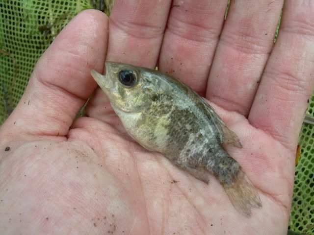
 - these guys were in breeding condition. The picture is of a male, we caught plenty of gravid females though.
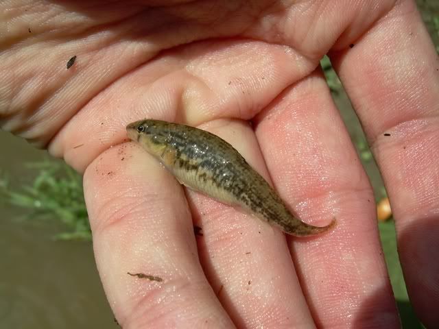
 - these were the most abundant darter in this stream, and habitat was particularly favorable for them. 1st picture is a gravid female, 2nd picture is a male.
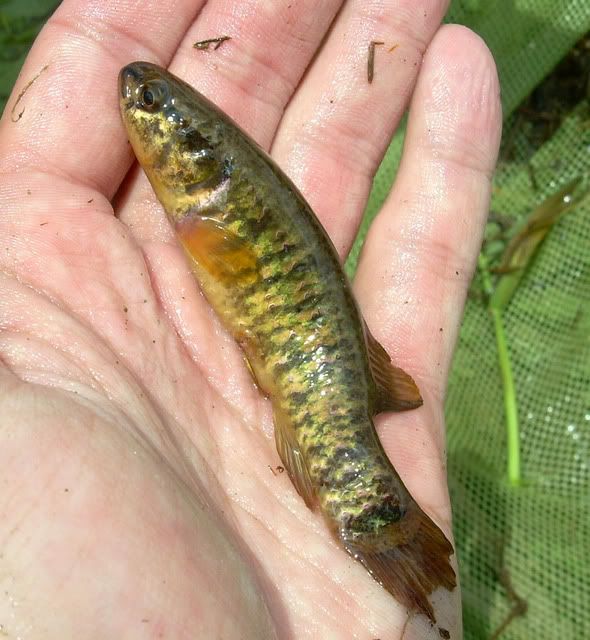
 - most abundant fish in the ditch.